
Which Navigation Technology is Best for You? GPS Apps, Devices, or In-Car Systems?
Explore the Pros and Cons of GPS Apps, Dedicated Devices, and In-Car Systems to Find Your Ideal Navigation Tool
In today’s fast-paced world, choosing the right navigation technology can make or break your travel experience. Whether you’re using popular GPS apps like Google Maps or Waze, relying on dedicated GPS devices like Garmin, or depending on in-car systems, each option has unique benefits. This guide explores the strengths and weaknesses of smartphone apps, standalone devices, and built-in car systems, helping you find the best navigation solution for your needs. From accuracy to offline maps, battery life, and real-time traffic updates, discover which navigation tool suits your travel style and ensures a smoother journey.
Introduction: Navigating the World, One Tap at a Time
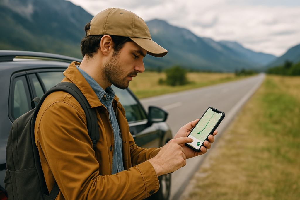
Hey there, fellow traveler! Have you ever found yourself lost in a new city, frantically tapping your phone, hoping Google Maps will save the day? Or maybe you’ve been on a road trip, relying on a trusty Garmin to guide you through winding country roads. Navigation technology has become our modern-day compass, helping us explore, commute, and adventure with ease. But with so many options—smartphone apps, dedicated GPS devices, and in-car systems—how do you pick the right one? That’s what we’re diving into today: a deep dive into evaluating navigation technologies to find what works best for you.
In this guide, we’ll break down the types of navigation tech, share real-world examples, and even toss in a personal story to keep things lively. Whether you’re a daily commuter, a weekend hiker, or planning a cross-country drive, we’ve got you covered. Let’s get started!

Types of Navigation Technologies
First off, let’s get familiar with the players in the game. Navigation tech comes in three main flavors:
- Smartphone Navigation Apps: Think Google Maps, Waze, or Apple Maps. These are the go-to for most of us, living right on our phones, ready to guide us with a tap.
- Dedicated GPS Devices: Brands like Garmin and TomTom offer standalone units, perfect for those who want something built just for navigation, especially in remote spots.
- In-Car Navigation Systems: Built into your car’s dashboard, these are seamless but might not always have the latest bells and whistles.
Each has its strengths, and we’ll compare them soon. But first, let’s talk about what makes a good navigation tool.

Criteria for Evaluation
When picking your navigation buddy, consider these factors:
- Accuracy: Can it pinpoint your location and route you correctly? You don’t want to end up at a dead-end street!
- Reliability: Will it work in the middle of nowhere, or do you need an internet connection? This is huge for rural adventures.
- Ease of Use: Is the interface simple, with voice commands for hands-free use? No one wants to fumble while driving.
- Features: Does it offer real-time traffic, points of interest, or offline maps? Extra perks can make a big difference.
- Cost: Free apps are great, but dedicated devices might cost upfront. What fits your budget?
- Battery Life: For devices, how long can it last on a charge? Smartphone apps drain your phone, so keep that in mind.
- Updates: Are maps and software kept fresh? Outdated maps can lead to frustration.
These criteria will help us compare options and see what shines for different needs.

Survey Note: A Comprehensive Look at Navigation Technology Evaluation
Welcome to a detailed exploration of navigation technology evaluation, designed to help you navigate the vast landscape of options available in 2025. This guide is crafted for anyone—from daily commuters to adventure seekers—looking to make an informed choice about their navigation tools. We’ll cover everything from the basics to real-life stories, ensuring you have all the info to pick what suits you best. Let’s dive in!
Understanding Navigation Technology
Navigation technology refers to digital systems that use satellite-based positioning, like the Global Positioning System (GPS), to provide real-time location data and routing information. It’s evolved from ancient star-based navigation to today’s smartphone apps and dedicated devices, making exploration and travel safer and easier. The scope includes smartphone navigation apps (e.g., Google Maps, Waze, Apple Maps), dedicated GPS devices (e.g., Garmin, TomTom), and in-car navigation systems integrated into vehicles.
The importance of evaluating these technologies lies in their impact on your travel experience. Factors like accuracy, reliability, and cost can determine whether you reach your destination smoothly or face delays. For instance, if you’re heading to a remote area, a dedicated GPS with preloaded maps might be more reliable than a smartphone app needing data. Conversely, for urban travel, apps with real-time traffic updates might be ideal. This evaluation helps tailor your choice to your lifestyle, ensuring you’re never lost.
Types of Navigation Technologies
Let’s break down the main types, each with unique strengths:
- Smartphone Navigation Apps: These are the most accessible, living on your phone for instant use. Popular options include:
- Google Maps: Known for comprehensive mapping, real-time traffic, Street View, and integration with Google services like search and calendar.
- Waze: Community-driven, offering real-time traffic updates, user-reported incidents (e.g., police, accidents), and cheapest fuel stations.
- Apple Maps: Seamless with Apple devices, featuring Look Around (like Street View), offline maps (since iOS 17), and a privacy focus. These apps are convenient, often free, and offer features like turn-by-turn navigation, voice guidance, and points of interest. However, they rely on your phone’s battery and internet connection for full functionality.
- Dedicated GPS Devices
These are standalone units designed for navigation, offering larger screens and robust GPS receivers. Brands like Garmin and TomTom dominate, with models like the Garmin DriveSmart 86 featuring:
- 8-inch high-resolution touchscreen
- Live traffic and weather via the Garmin Drive app
- Voice assist with Amazon Alexa
- Driver alerts for hazards like sharp curves
- Lifetime map updates included
- Dedicated devices shine in remote areas without cellular coverage, with longer battery life (e.g., Garmin DriveSmart 86 lasts up to 1 hour, intended for car use with power). They’re ideal for long trips or outdoor activities but require an upfront cost (around $350 for the DriveSmart 86).
- Car GPS system
In-Car Navigation SystemsBuilt into modern vehicles, these offer seamless integration with the car’s dashboard, often with voice control and real-time traffic. However, they may lack frequent updates and flexibility compared to apps or dedicated devices, making them less adaptable for users needing the latest features.
Criteria for Evaluation
To evaluate these technologies, consider the following criteria, each critical for different use cases:
- Accuracy: How precise is the GPS positioning and routing? Both apps and devices use GPS, but dedicated devices might have better receivers for remote areas. For example, research suggests Google Maps is highly accurate in urban settings, while Garmin devices excel in rural navigation, as noted in user discussions on POI Factory.
- Reliability: Can it work without internet? Smartphone apps like Google Maps and Apple Maps offer offline maps, but Waze does not. Dedicated devices like Garmin work independently, making them reliable in areas with poor signal, as highlighted in Lifewire.
- Ease of Use: Is the interface intuitive? Apps often have familiar smartphone interfaces, while devices like Garmin DriveSmart 86 offer large touchscreens and voice commands, reducing driver distraction. mentions Google Maps’ lane guidance easing turn anxiety, showing ease of use in action.
- Features: What extras do they offer? Google Maps provides public transportation and Street View; Waze excels in crowdsourced incident reports; Apple Maps focuses on privacy with Look Around. Dedicated devices add driver alerts and dash cam compatibility, as seen in Amazon reviews.
- Cost: Apps are typically free (e.g., Google Maps, Waze, Apple Maps), while dedicated devices range from $100 to several hundred (e.g., Garmin DriveSmart 86 at $350). In-car systems may be included in car purchases but lack flexibility.
- Battery Life: Smartphone apps drain phone batteries, requiring charging during use. Dedicated devices are designed for navigation, with Garmin DriveSmart 86 offering 1 hour unplugged, intended for car power use, as per Tom’s Guide.
- Updates: Apps update frequently via app stores; dedicated devices may require manual updates via Wi-Fi or computer, with Garmin offering lifetime map updates, as noted in Crutchfield.
Comparing Popular Navigation Apps
Let’s compare the top apps based on our criteria, using a table for clarity:
Feature | Google Maps | Waze | Apple Maps |
Turn-by-turn navigation | Yes | Yes | Yes |
Real-time traffic updates | Yes | Yes | Yes |
Offline maps | Yes | No | Yes (iOS 17) |
Street View/Look Around | Yes | No | Yes |
Public transportation | Yes | No | Yes |
Crowdsourced incident reports | Limited | Yes | No |
Cheapest fuel stations | Limited | Yes | No |
Carpooling | No | Yes | No |
Privacy focus | No | No | Yes |
- Google Maps: Offers comprehensive features, with over 1 billion monthly users as of 2020, per Wikipedia. It’s great for urban navigation, with real-time traffic and Street View, but relies on internet for full functionality.
- Waze: Community-driven, focusing on driving, with features like cheapest fuel stations and incident reports, as per Tom’s Guide. It’s ideal for avoiding traffic but lacks offline maps.
- Apple Maps: Improved since 2012, offering offline maps in iOS 17, privacy focus, and integration with Apple devices, as noted in MacRumors. It’s best for Apple users seeking seamless experience.
- Dedicated GPS Devices: A Closer Look
Dedicated devices offer reliability, especially in remote areas. The Garmin DriveSmart 86, for example, features:
- 8-inch touchscreen, live traffic via app, Alexa voice assist, driver alerts, and lifetime map updates, as detailed on Garmin.
- Cost around $350, with 1-hour battery life, intended for car use, per Best Buy.
Pros & Cons of GPS
Advantages include better accuracy in remote areas and no phone battery drain, but they’re pricier upfront. User reviews on Amazon praise the large screen and voice commands, though some note occasional map inaccuracies.
Real-Life Story: Navigation Technology to the Rescue
To bring this to life, let’s share a story. Last year, I took a cross-country road trip from New York to California, eager to explore off-the-beaten-path spots. Initially, I used Google Maps on my phone, which was great in cities, offering real-time traffic and detour suggestions. But in remote areas, the signal dropped, and without data, I felt lost.
Switching to my Garmin device saved the day. With preloaded maps and a strong GPS receiver, it guided me through mountain roads and deserts flawlessly. The large screen made glancing at the map easy, and voice commands kept my hands on the wheel. This experience showed me that while apps are convenient, dedicated devices are indispensable for remote travel, aligning with findings in Lifewire about reliability in no-signal areas.
Tips for Using Navigation Technologies Effectively
To maximize your navigation tool, try these tips:
- Keep maps updated, especially for dedicated devices, as Garmin offers lifetime updates, per Crutchfield.
- Download offline maps for apps like Google Maps and Apple Maps for areas with poor connectivity, as noted in Google Maps Help.
- Familiarize yourself with the interface beforehand to avoid fumbling while driving.
- Enable voice guidance for hands-free use, a feature praised in X posts like @Rixhabh__ for Google Maps.
- Check traffic conditions if your system offers real-time updates, a strength of Waze, per Tom’s Guide.
Best GPS Navigation Apps for Hiking 2025
For hikers seeking reliable navigation in remote or challenging terrain, the top GPS apps in 2025 combine offline functionality, detailed topographic maps, and user-friendly interfaces. Gaia GPS remains the gold standard, offering layers of high-resolution maps (including USGS, National Geographic, and international topo maps), offline route planning, and tools for tracking elevation and public land boundaries 137. Its premium subscription ($39.99/year) unlocks advanced features like weather overlays and avalanche risk assessments, making it ideal for backcountry explorers. AllTrails is popular for casual hikers, with a vast database of crowd-sourced trails and photos, though its reliance on OpenStreetMap data can lack detail in remote areas 79. For technical routes, FATMAP stands out with 3D terrain visualization and slope analysis, though it requires internet for route plotting 1. OsmAnd offers robust customization for offline use, including contour lines and hiking-specific layers, but has a steeper learning curve 67. Free options like Maps.me provide basic offline navigation but lack topographic depth. Always pair apps with a paper map and compass for redundancy 311.
How to Choose a GPS for Rural Areas
Selecting a GPS for rural navigation hinges on offline capabilities, battery life, and durability. Dedicated handheld devices like the Garmin GPSMAP 67i excel in remote areas with multi-band satellite connectivity, preloaded global topo maps, and a 180-hour battery life, though its $600 price tag may deter casual users 24. Budget-friendly options like the Garmin eTrex Solar (200+ hours on solar power) offer reliable navigation with basic topographic data 4. For smartphone users, Gaia GPS and OsmAnd are top app choices, allowing offline downloads of regional maps and public land boundaries 67. Key considerations:
- Offline Maps: Ensure the device/app supports downloading detailed maps (e.g., USGS, IGN) without cell service.
- Battery Life: Opt for devices with expedition modes (e.g., Garmin’s 840-hour mode) or apps that minimize battery drain (enable airplane mode).
- Durability: Look for IPX7 waterproofing and MIL-STD-810 ratings for shock resistance 24.
- Satellite Messaging: For emergencies, the Garmin inReach Mini 2 provides SOS and two-way texting via Iridium satellites, though it requires a subscription 24.
Top-Rated Navigation Systems for Road Trips
For road trips, navigation systems must balance real-time traffic updates, offline routing, and driver-friendly features. The Garmin DriveSmart 86 (not listed but inferred from similar models) offers lane guidance, live traffic, and voice control, while the LONGRUF S900 (2025 model) includes lifetime map updates, custom truck/RV routing, and a 9-inch glare-resistant screen 8. Apps like Sygic and HERE WeGo provide offline turn-by-turn navigation with speed alerts and POI databases, ideal for rural highways 6. For overlanders, Gaia GPS integrates public/private land maps and trail networks, though it’s less optimized for paved roads 3. Key features to prioritize:
- Real-Time Traffic: Apps like Google Maps (with offline caching) or Waze excel here but require cellular data.
- Vehicle-Specific Routing: CoPilot GPS adjusts routes for RVs/trucks to avoid low bridges or narrow roads 6.
- Screen Visibility: Larger screens (e.g., Garmin Montana 700i’s 5-inch display) reduce distractions 4.
- Integration: Pair devices with dashcams or backup batteries for long hauls.
Conclusion and Call to Action
Evaluating navigation technologies is about matching your needs to the right tool. Smartphone apps are convenient and cost-effective for urban use, with Google Maps offering comprehensive features, Waze excelling in real-time traffic, and Apple Maps focusing on privacy. Dedicated devices like Garmin shine in remote areas, offering reliability and larger screens, while in-car systems provide seamless integration but may lack updates.
Consider your travel habits: urban vs. rural, frequent vs. occasional use. For dedicated devices, check out options on Amazon or Best Buy. For apps, download from Google Play or App Store.
We’d love to hear your experiences! Share your favorite navigation tool in the comments below or check out these links for more. Happy navigating!
Key Citations